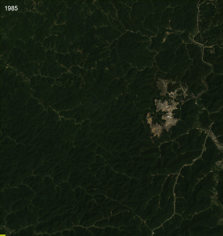
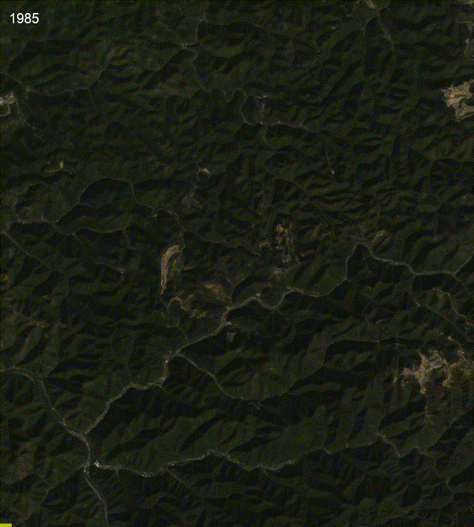
Satellite Timelapse of Mining
Timelapses showing the 40-year landscape changes from two mines in West Virginia, shared on SkyTruth’s website and social media posts.
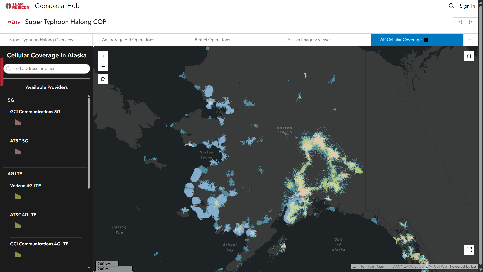
Typhoon Halong
With Team Rubicon, I created this dashboard showing cell coverage in Alaska, as part of a larger ArcGIS Hub site, to support planning and field coordination during the response to Typhoon Halong in Alaska.
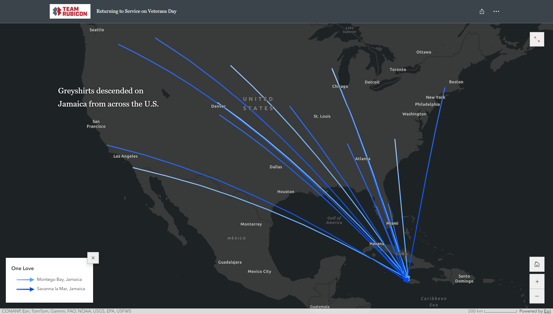
Hurricane Melissa
With Team Rubicon, I created maps for this published story map showing where Team Rubicon volunteers traveled to support disaster response in impacted regions.
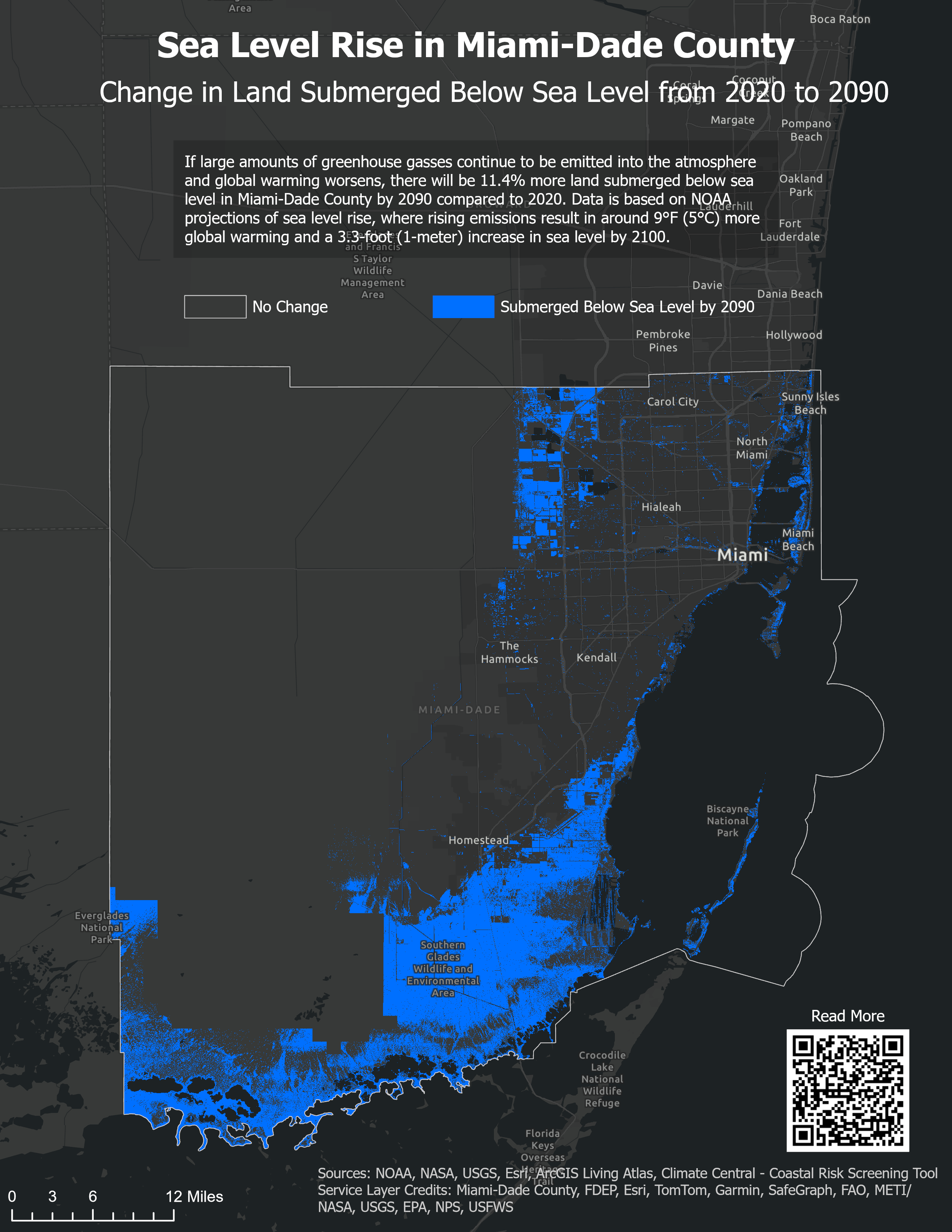
Sea Level Rise
Sea level rise in Miami-Dade County using NOAA data, visualized using ArcGIS Pro.