Mapping Tree Mortality from Space with Machine Learning
Understanding tree mortality over time provides crucial insights for habitat restoration, environmental modeling, conservation efforts, and more. However, accurate, high-resolution tree mortality data is often lacking, especially for expansive areas unfeasible for conducting field surveys.
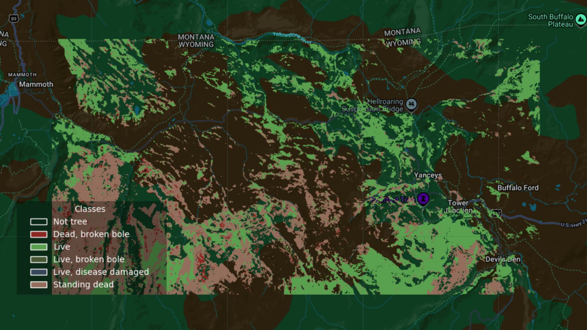
Machine learning allows us to expand and map tree mortality across a region using sampled data. This report shares preliminary results comparing various machine learning methods to predict tree mortality and disease at a 10-meter resolution using the National Ecological Observatory Network (NEON)’s field survey data, paired with Google’s Satellite Embeddings, which distill satellite images, radar, digital elevation models, and climate simulations into annual, publicly-available imagery.