Logo Olivia Zhang
  • Home
  • About
  • Projects
  • Skills
  • Experiences
  • Education
  • Posts
  • Notes
  • Dark Theme
    Light Theme Dark Theme System Theme
Logo Inverted Logo
  • Tags
  • AI
  • Art
  • Data
  • Extracurricular
  • GIS
  • Reflection
  • Research
Hero Image
Mapping Tree Mortality from Space with Machine Learning

Understanding tree mortality over time provides crucial insights for habitat restoration, environmental modeling, conservation efforts, and more. However, accurate, high-resolution tree mortality data is often lacking, especially for expansive areas unfeasible for conducting field surveys. Machine learning allows us to expand and map tree mortality across a region using sampled data. This report shares preliminary results comparing various machine learning methods to predict tree mortality and disease at a 10-meter resolution using the National Ecological Observatory Network (NEON)’s field survey data, paired with Google’s Satellite Embeddings, which distill satellite images, radar, digital elevation models, and climate simulations into annual, publicly-available imagery.

  • AI
  • GIS
Friday, December 12, 2025 | 3 minutes Read
Hero Image
GIS for Disaster Response

In 2025, I started volunteering with Team Rubicon, a national nonprofit organization that organizes international disaster response efforts to disasters like hurricanes, wildfires, and floods. On their GIS team, I provide GIS support to a range of projects, from creating interactive dashboards for use in planning disaster response to labeling flooded roads and fallen trees in high-resolution satellite imagery taken in the aftermath of a disaster. Living in South Florida, I have seen the impacts of hurricanes and other disasters on our communities. As a geography and data science student, much of my work and research involves geographic information systems (GIS), which allow us to visualize data on maps and analyze spatial patterns.

  • Reflection
  • GIS
Friday, November 21, 2025 | 1 minute Read
Hero Image
Reflecting on a Summer of Mapping for Impact

Mapping Justice: Gulf Coast This summer, I supported Mapping Justice, our 8-week summer program for high school students, where they learn about geographic information systems (GIS), environmental challenges along the Gulf Coast, and how they can design tools for impact. From helping with parts of the curriculum to editing recordings, I learned so much about all the behind-the-scenes work that ensures the program runs smoothly. I am inspired by the students’ incredible work throughout the course of the program. You can view their projects here, exploring environmental issues along the Gulf region. Helping with this program reminded me of my first time learning about GIS in high school, and how I found it so fascinating how we can use GIS to uncover spatial patterns and tell stories with data.

  • Reflection
  • GIS
Thursday, August 14, 2025 | 3 minutes Read
Hero Image
Reflecting on the Gulf Scholars Conference in Mobile, Alabama

I have been working with trubel&co since December 2023 and have loved every moment of it, from helping with EcoGIS workshops to Mapping Justice. Having been born in New Orleans and raised in South Florida, the Gulf is a region especially close to my heart. When I learned that trubel&co is expanding the Florida Mapping Justice program to all Gulf Coast states, I was very excited to be able to help.

  • Reflection
  • GIS
Friday, May 16, 2025 | 2 minutes Read
Hero Image
Detecting Shell Mounds in LiDAR Images

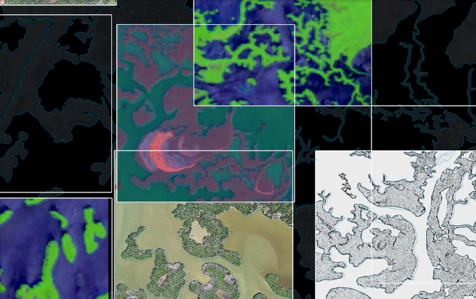
Project Overview Shell mounds, or shell middens, are hills of accumulated shell (clams, oysters, and whelks), mud bricks, pottery shards, and other objects built up by generations of Indigenous peoples (Orengo et al., 2020; Florida Natural Areas Inventory, 2010). Shell mounds, found along the coastlines of the southeastern United States (Florida Natural Areas Inventory, 2010), give us a look at the past, helping us understand the lives of communities from hundreds to thousands of years ago. As such, they are a crucial part of our cultural landscape—imprinted evidence of history and heritage on the natural landscape (Taylor & Lennon, 2011).

  • Research
  • Data
  • GIS
Monday, April 15, 2024 | 12 minutes Read
Navigation
  • About
  • Projects
  • Skills
  • Experiences
  • Education
Contact me:
  • via-zhang
  • Olivia Zhang

Toha Theme Logo Toha
2025 Portfolio
Powered by Hugo Logo